


Know What's Happening Before It Reaches Your Door


Capabilities
Everything happening around you — weather, crime, scanners, aircraft, infrastructure — fused into a single real-time operational picture.
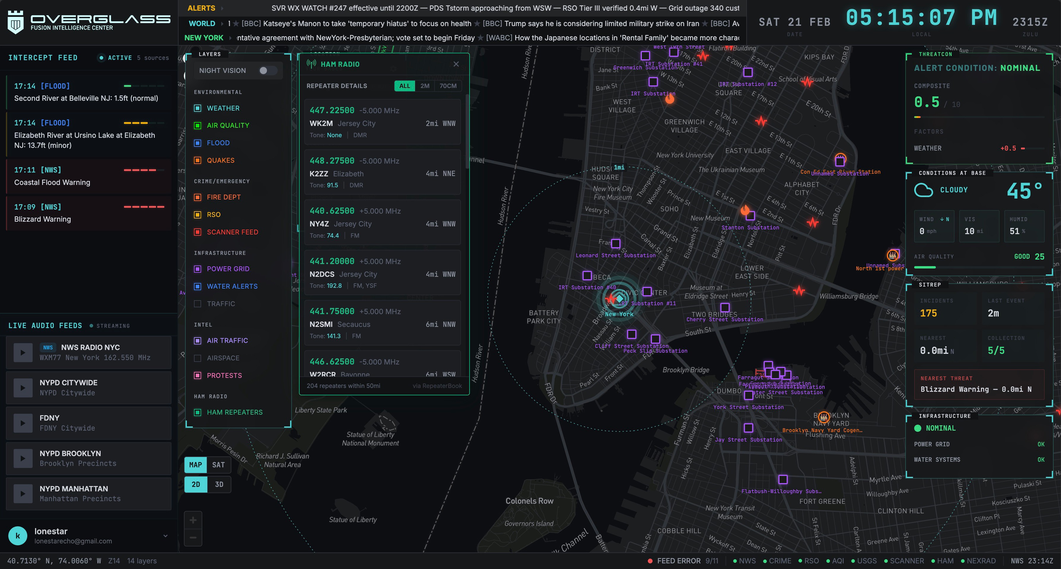
Unified Threat Picture
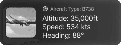
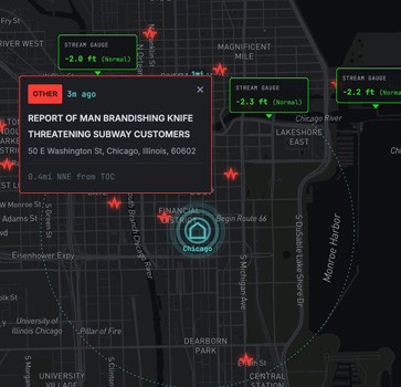
A unified threat map for your neighborhood, home, and family. NWS weather alerts and live radar. USGS earthquake monitoring. Real-time crime reports with sex offender proximity alerts. Power outage maps with restoration ETAs. Water contamination and boil orders. Air quality index. Live aircraft tracking. Flood gauges — all plotted on one tactical map with range rings, threat markers, and night vision mode.
Live Intel Feeds
Live police, fire, and EMS scanner audio from 50+ metro areas — listen to first responder dispatch channels as incidents unfold in your area. Local news aggregation, civil event monitoring, protest tracking, and community-reported activity. Raw intelligence streaming alongside your map so you hear what's happening, not just see it.
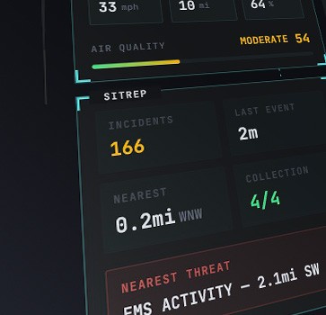
Readiness Assessment
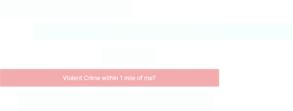
A composite threat level score (0–10) — our THREATCON system — that analyzes severe weather, local crime trends, power grid status, and nearby active incidents to tell you your family's current risk level at a glance. Five threat levels from Nominal to Critical. Plus auto-answered Priority Intelligence Requirements — "Severe weather within 25 miles?" "Violent crime within 1 mile?" "Power outage in my area?" — yes or no, instantly.
How It Works
From Scattered Data to Complete Awareness
OverGlass does the work of monitoring and analyzing 25+ sources so you don't have to. Set your location (or multiple), and your operational picture builds itself.
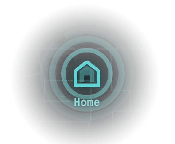
Set Your Location
Add your home, office, kids' school, or your parents' house. OverGlass supports monitoring multiple locations at once so you stay aware of every place that matters — not just where you are right now.
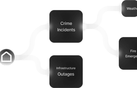
Automatic Data Fusion
Your 25+ feeds activate automatically around each location — NWS weather alerts, earthquake data, police scanners, crime reports, power outages, air quality, live flight tracking, and more. All in real time.
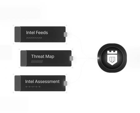
Your Real-Time Situational Awareness Dashboard
Everything renders on a three-panel tactical dashboard: raw intel feeds on the left, your threat map in the center, and automated assessment cards on the right. One screen. No tab-switching.
Instant Answers to the Questions That Matter
Auto-answered questions tailored to your situation: "Severe weather within 25 miles?" "Violent crime within 1 mile in 24 hours?" "Power outage affecting my area?" Yes or no. Instantly.
Pricing
One Plan. Everything Included.
One simple plan. Every real-time feed, full situational awareness - less than the cost of a streaming subscription.
FAQs
Questions? Answered.
Get answers to the most common questions and learn how to make the most of overglass.io
What is OverGlass?
A personal situational awareness platform that aggregates 25+ real-time data feeds — weather alerts, crime reports, police scanners, air quality, infrastructure outages, and more — into a single tactical dashboard. Think of it as your personal intelligence fusion center.
Who is OverGlass for?
Families who want to know what's happening near their home and kids' schools. Preparedness-minded individuals who value advance warning and a sharp intel picture. Small business owners monitoring local conditions. Security professionals who need a consolidated operational picture.
Where does the data come from? Is this legal?
All data comes from publicly available sources — official government APIs (National Weather Service, USGS, EPA, FEMA), emergency dispatch systems, crime reporting databases, aviation tracking, and more. No classified or private data is used. And yes, it's legal. OverGlass exclusively uses open-source intelligence (OSINT). We aggregate and analyze it so you don't have to check dozens of different sources yourself.
How is OverGlass different from a news app or weather radar app?
Individual apps show you one slice of the picture. OverGlass fuses weather, crime, scanners, air quality, infrastructure status, aircraft, and more into one real-time view — so you can see patterns and emerging threats that no single app can show you.
What cities and regions does OverGlass cover?
OverGlass provides nationwide US coverage. Scanner feeds are currently available in 50+ metro areas with more being added regularly.
Is my location data private? How does OverGlass handle personal data?
Yes. Your location data is stored securely and never sold to advertisers or third parties.